The story of the polders
The story of the polders
The dry spell opened the eyes of the water board and the provincial authority: climate change can have a great influence on the safety of the land inside the dikes. Permanent dike monitoring was thus a necessity during that dry spell in 2011.
Low land
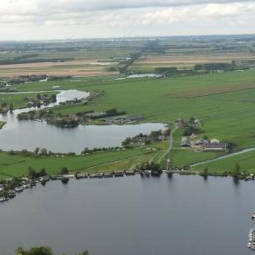
Whoever looks around the land of Kaag en Braassen, will notice that the land consists of polders which are protected by hundreds of kilometres of dikes. The water laps against the edge of the dike and on the other side the land lies metres deep. High dikes and low-lying land that is only subsiding further, so that it comes to lie ever lower. It is precisely in this municipality, primarily between the Westeinderplassen and the Braassemermeer, that arid-sensitive peat dikes which are centuries old are situated, but which still keep our feet dry.
Oxidisation
It is hard to imagine, but at one point this same land was few metres above sea level. Human intervention created the situation as it is now. In the past this entire area consisted of bogs, which in turn consists of 90 percent water. After the year 800 humans started to reclaim the area. Canals and waterways were excavated to remove the water. This drainage caused the bog to lose its volume and subside, so that the land came to lie lower and lower. The drainage also caused part of the peat to rise above water level, so that peat was consumed – oxidised. This in turn resulted in the land subsiding even more. An unstoppable process.
Windmills
Because the land had subsided so much, at a given point in time it was necessary to set up dikes. And because the land behind the dikes continued to subside, drainage was again necessary to pump away the excess water, within those dikes. The many windmills are the silent witnesses of that period. The many lakes which were created, were drained dry. Somehow or other the Braassemermeer continued to dodge the bullet – to the great enjoyment of many water sports’ lovers.
Priest Hendrik
Land reclamation was not undertaken by the common man. Land owners and the church played a major role in this respect. In Kaag en Braassem, Priest Hendrik was an important figure behind the substantial land reclamation which took place in the Netherlands between the years 1000 and 1300. His influence can still be seen in the landscape. One characteristic of this region are the elongated plots of 1250 x 113 metres. In order to reclaim such a plot a contract was necessary, which was known as a "cope". The Count of Holland and the Bishop of Utrecht sold these copes to colonists, who reclaimed the area in order to work the land. By reclaiming such a wild plot of land, the buyers acquired the status of free farmer.
Statue
This "cope" landscape cannot be found anywhere else in the world, except in Das Alte Land in Germany, situated between Hamburg and Bremen. On the request of Bremen's arch bishop, Father Hendrik went to the area to develop the land there too. Naturally he brought along his experience in Holland and that is how there are polders in Germany which are the same as the Dutch peat polders. A statute, two to be precise (identical ones at that) were dedicated to Father Hendrik for his important work during the reclamation. Since 1993 the original statue has been standing in front of the Evangelical-Lutheran St. Martini-et-Nicolai-Kirche in the German village of Steinkirchen. A replica of it has been on the square in front of the Woudse Dom in Rijnsaterwoude since 2001.


